An Historical Atlas of the University of Wisconsin-Madison Campus
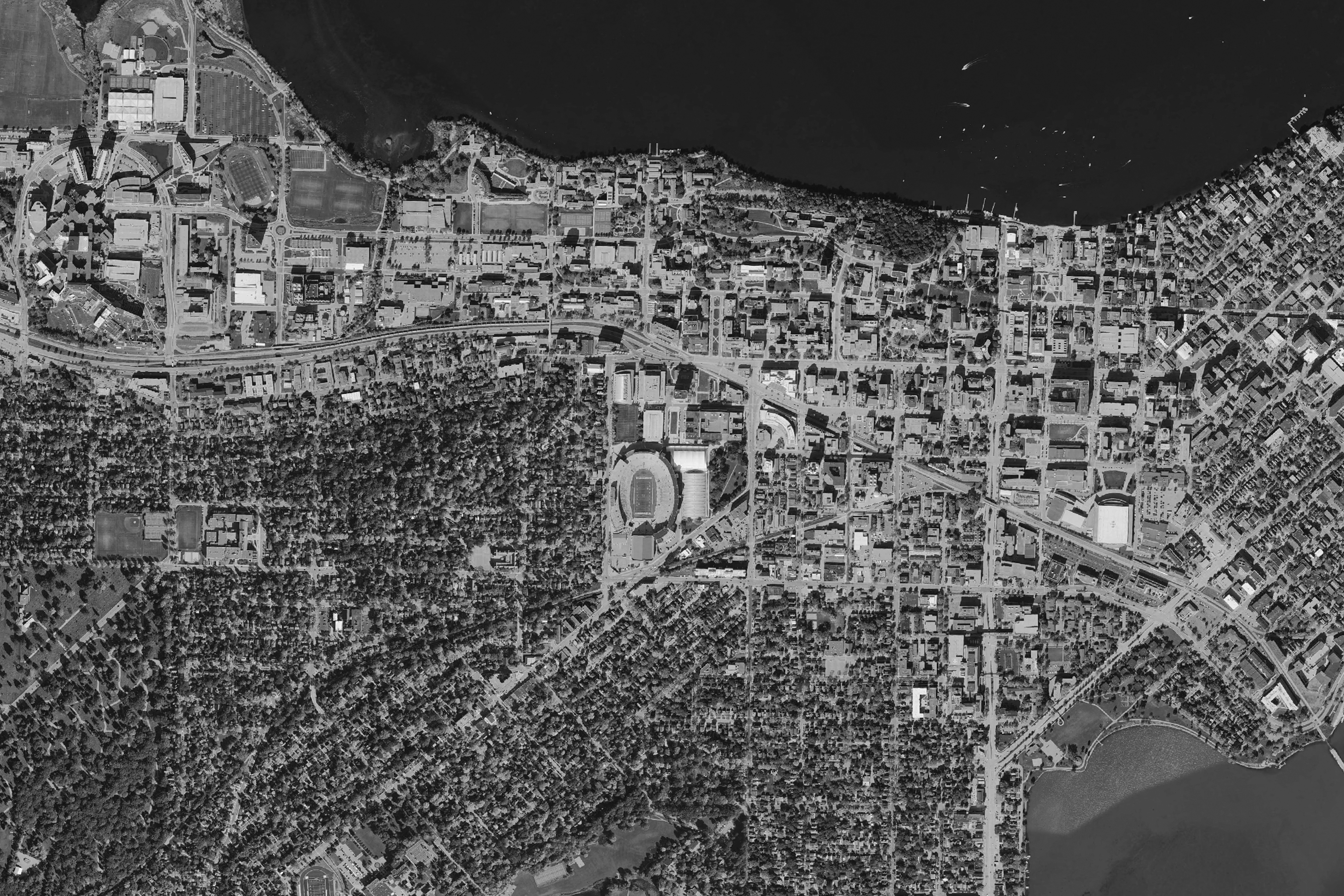
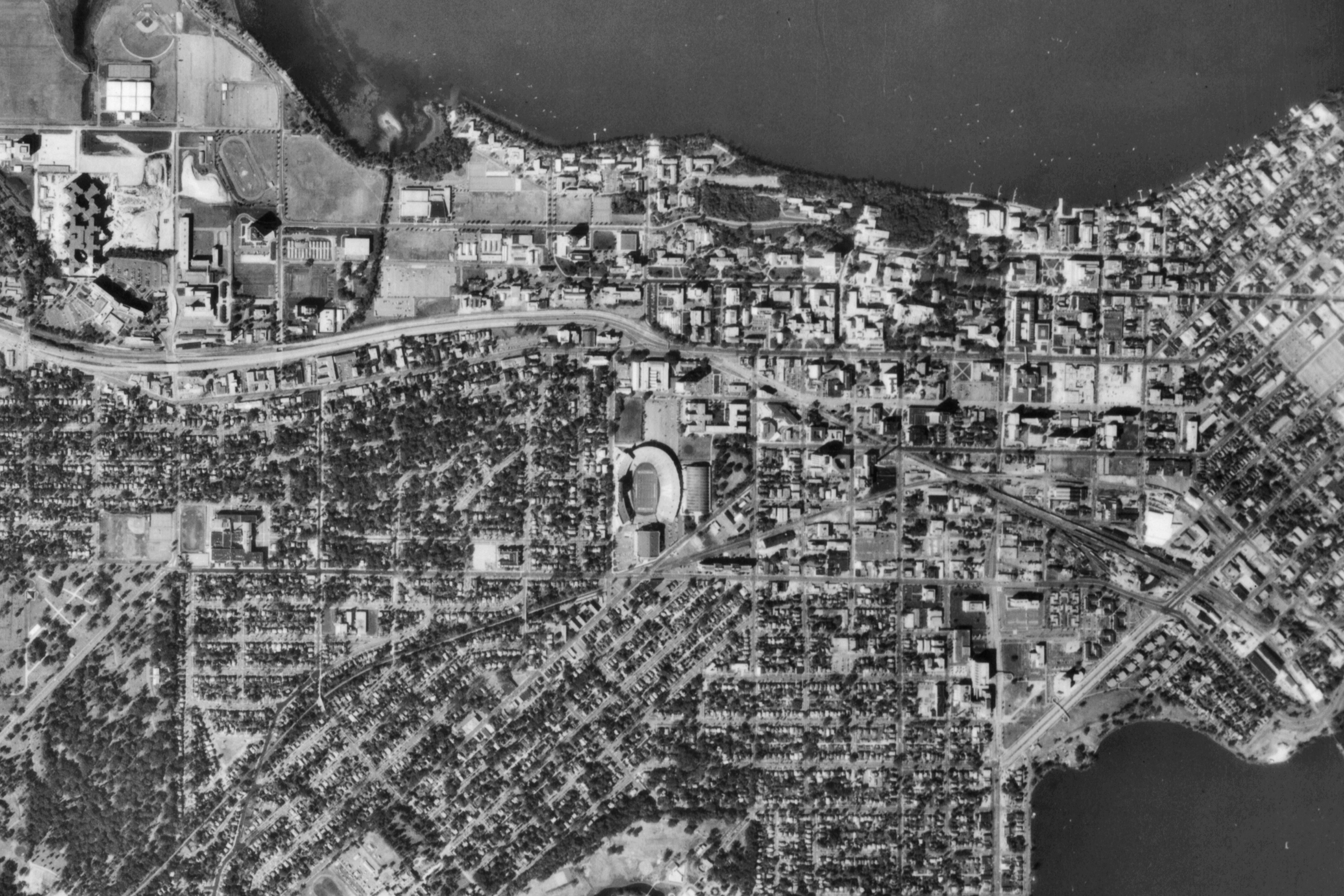
On this page, we've assembled a sequence of historic aerial photographs that will enable you to explore the growth and changing landscapes of the UW-Madison campus from 1937 (the year the first such aerials began systematically to be taken) until the present. Below you'll find thumbnails for each of the aerial photos we've scanned; stitched together; cropped to a uniform size to match roughly the current boundaries of the campus; and processed for web presentation. As the semester unfolds, we're hoping to add at least a few more, but these should be enough to get you started.
Below you'll find low-resolution thumbnails for each aerial, which you can explore in much higher resolution in either JPG or PDF format. If you click on the thumbnail, you'll be taken to a high-resolution JPG; if you click on one of the two buttons beneath the thumbnail, you can choose between JPG or PDF. Whichever format you choose, the photo you'll see will be essentially identical, so it's really just a question of which format feels easier for you to navigate with the software available to you. You could, for instance, open up high-resolution JPGs in different tabs of your browser so that by moving among tabs you can compare places that interest you over time; alternatively, could open the PDFs in Adobe Acrobat Reader or whichever other PDF software you prefer, an environment that might be easier for certain kinds of panning and zooming to explore the aerial images.
Our hope is that these images will inspire you to think about the changing historical landscapes of the UW-Madison campus in new ways, comparing what you see in these images with what you see on the ground today. (Don't miss the additional links to other landscape history resources for the campus at the bottom of this page.) Have fun!

University of Wisconsin-Madison Aerial Photo, 2015 (color) JPG PDF
University of Wisconsin-Madison Aerial Photo, 2015 (B&W) JPG PDF
University of Wisconsin-Madison Aerial Photo, 1976 JPG PDF

University of Wisconsin-Madison Aerial Photo, 1949 JPG PDF
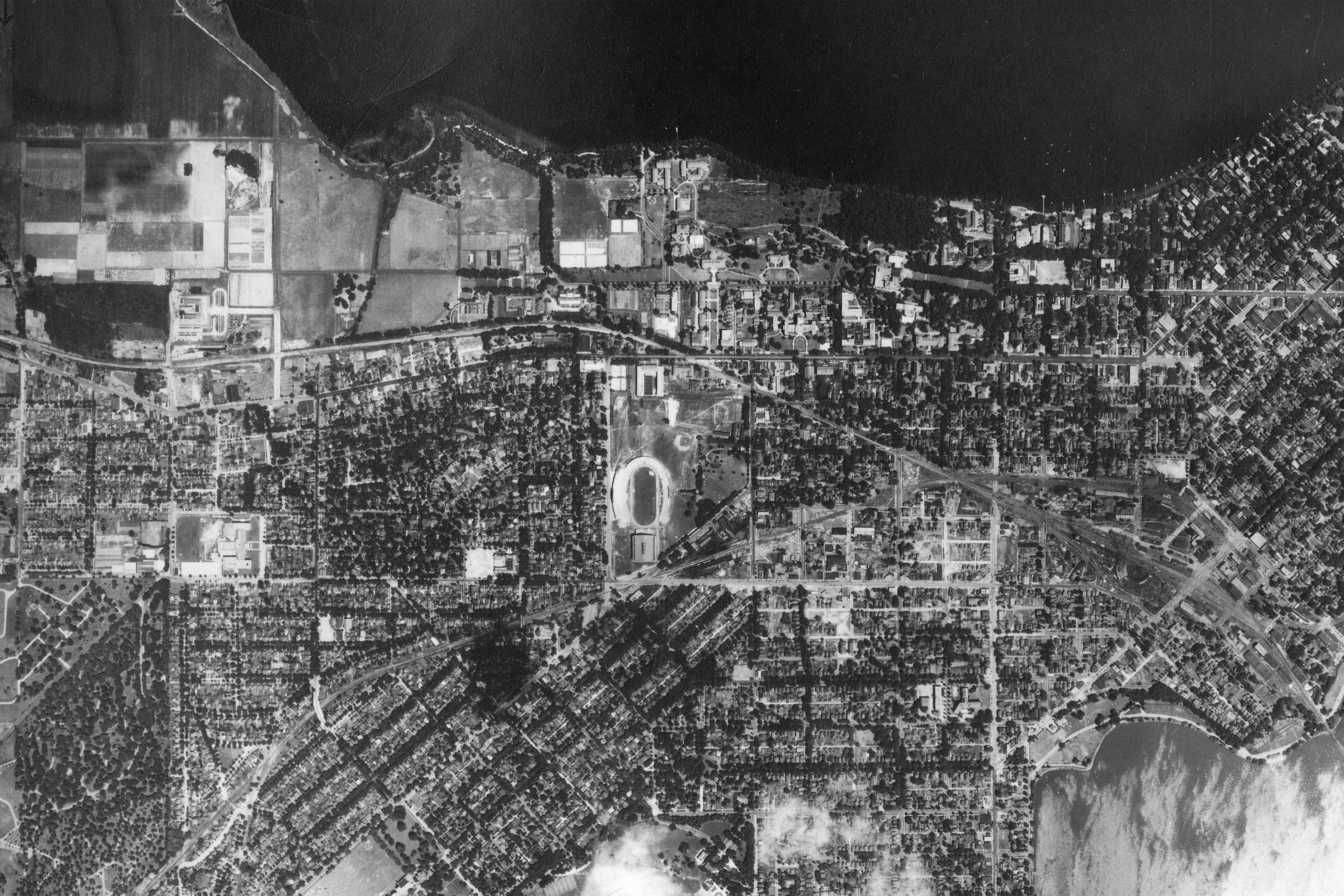
University of Wisconsin-Madison Aerial Photo, 1937 JPG PDF
For additional bird's-eye resources for exploring the changing campus landscapes of the University of Wisconsin-Madison, check out the following links:
Historic and Contemporary Plans for the UW-Madison Campus: fpm-www3.fpm.wisc.edu/campusplanning/CampusPlanningHome/Historic/tabid/63/Default.aspx
Historic Visitor Maps for the University of Wisconsin-Madison, 1937-2006: www.geography.wisc.edu/history/historic_UW_campus_maps.php
(This collection unfortunately appears to have been removed by the University.)
Cultural Landscape of the UW-Madison Campus, Landscape Inventory Reports:
fpm-www3.fpm.wisc.edu/campusplanning/CampusPlanningHome/CulturalLandscapes/tabid/64/Default.aspx
(This collection unfortunately appears to have been removed by the University.)
Cultural Landscape of the UW-Madison Campus, Digital Image Collection: uwdc.library.wisc.edu/collections/UW/UWCulturalLand
UW-Madison Image Collection: uwdc.library.wisc.edu/collections/UW/UWMadison
Wisconsin Historical Society Visual Materials: www.wisconsinhistory.org/Content.aspx?dsNav=N:1135

For a comprehensive collection of brief histories of individual buildings constructed on the UW-Madison campus before 1996, you will want to consult Jim FeLdman's wonderful The Buildings of the University of Wisconsin, published by the University Archives in 1997. Feldman's book has long been out of print, but its individual chapters are available for download as separate PDF files (arranged in chronological order by the building's first date of construction) at this link: digicoll.library.wisc.edu/cgi-bin/UW/UW-idx?id=UW.UWBuildings. We've also collated these PDFs into a single large file (12MB) with individual chapters arranged in alphabetical order by the original names of the building, to make navigating the text a little more intuitive for students. You can download that file here: PDF
Many thanks to Josie Sajbel for stitching, cropping, and processing the aerial photographs on this page; to Tanya Buckingham for general advice and supervision; to Jaimie Martindale for helping us locate maps and aerials at the UW-Madison Map Library; and to Spring Greeney for scanning original images and helping with myriad other aspects of the project.